Problem
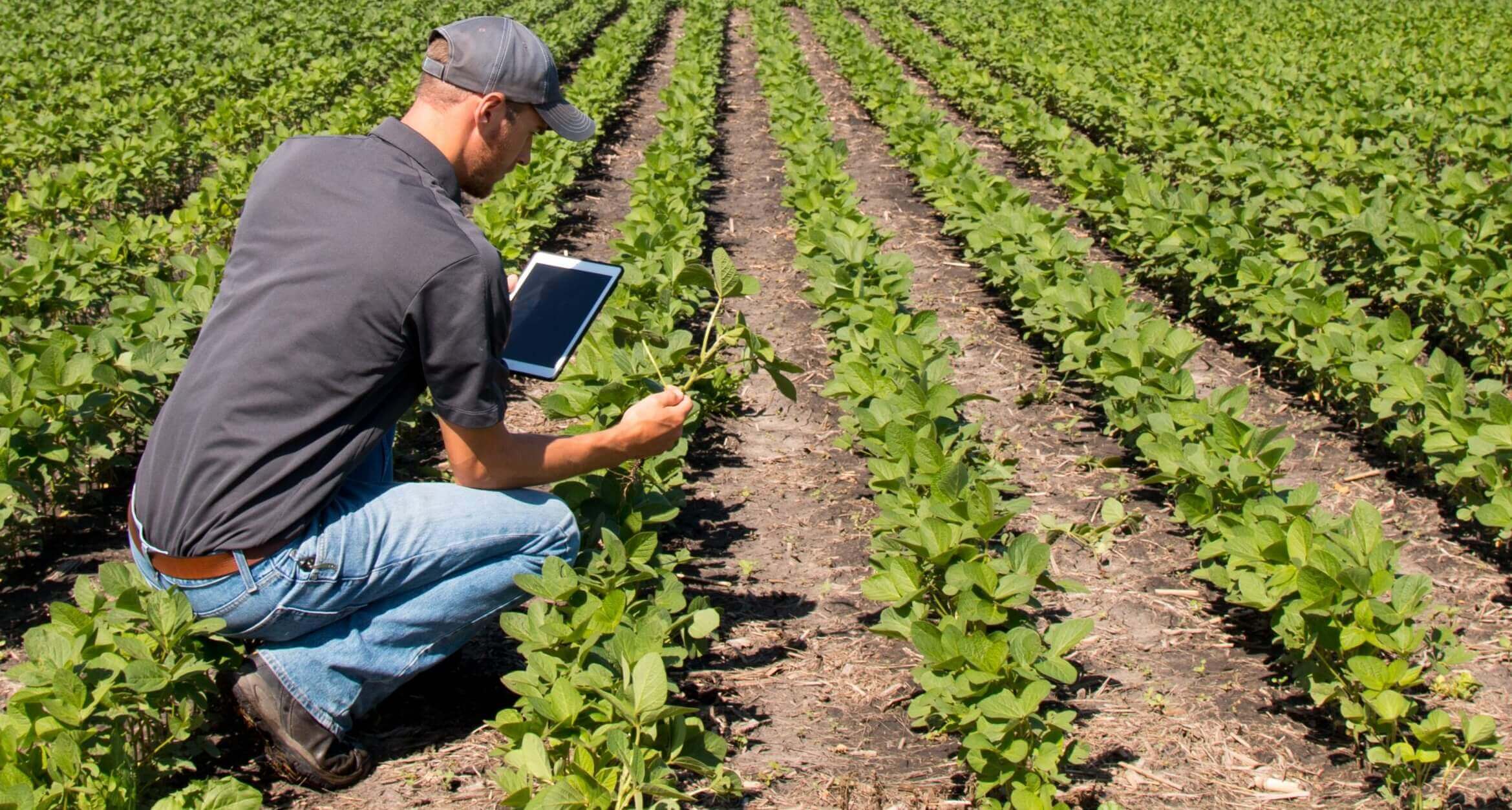
Manual agricultural audits are slow, expensive and difficult to scale across large territories. Field inspections require time, people and repeated verification, making the process inefficient for insurers, banks and public-sector entities.
Satellite-based crop auditing for agricultural monitoring, insurance validation and fraud detection.
CropAuditing connects a clear auditing problem with a scalable technical solution and practical value for institutions that need reliable agricultural verification.
Manual agricultural audits are slow, expensive and difficult to scale across large territories. Field inspections require time, people and repeated verification, making the process inefficient for insurers, banks and public-sector entities.
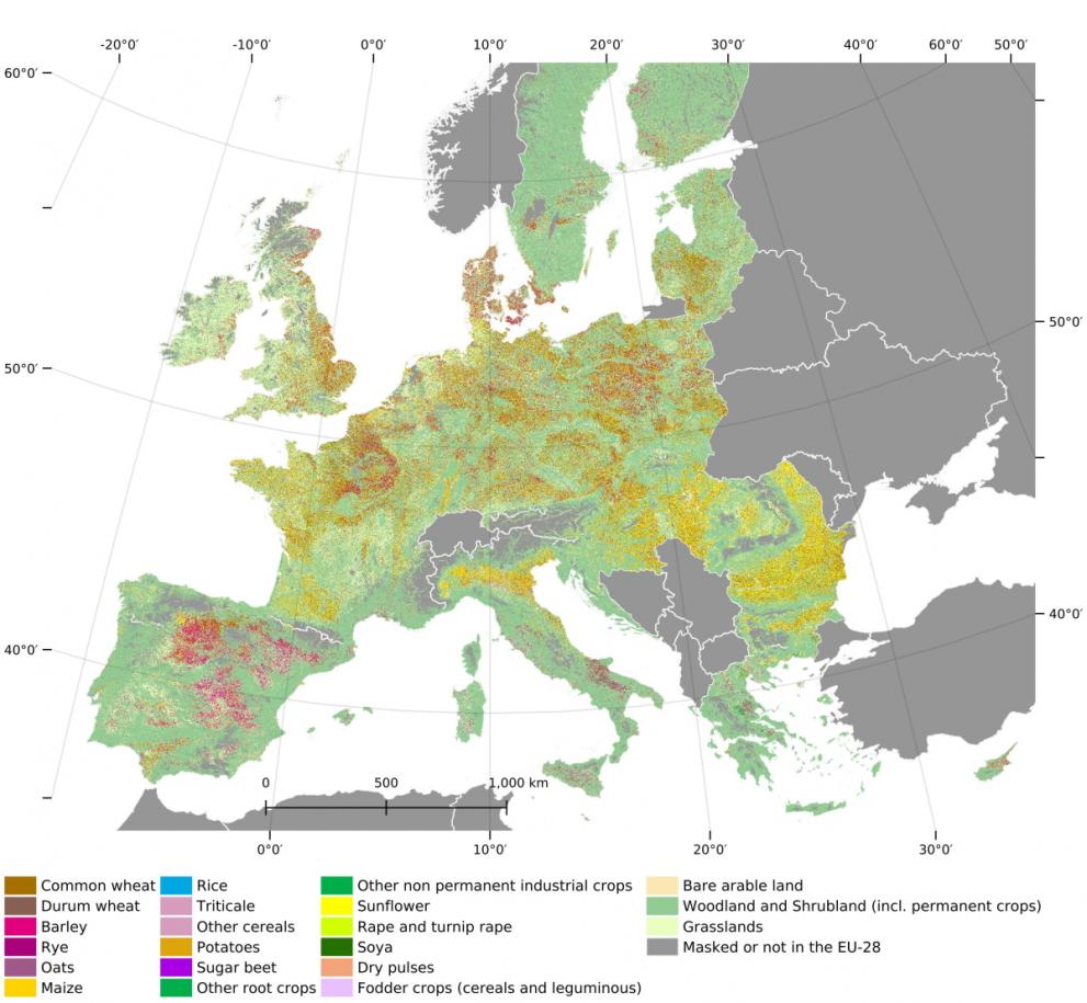
CropAuditing combines Sentinel-2 satellite imagery, NDVI time-series analysis and Machine Learning models to classify crop species, monitor growth stages and compare declared agricultural information with satellite-derived evidence.
The platform enables faster verification, scalable monitoring and stronger fraud or inconsistency detection, supporting more transparent decisions in insurance validation, agricultural subsidies and financial risk analysis.
CropAuditing is a technological solution developed to transform large-scale agricultural monitoring through the integration of satellite imagery, temporal analysis, and machine learning algorithms. Our solution addresses the limitations of traditional agricultural audits, which are often slow, expensive, and difficult to scale, offering an automated, accurate, and efficient system for crop identification and monitoring crop development over time. By converting complex geospatial data into clear and verifiable analytical information, CropAuditing optimizes audit processes for insurance companies, financial institutions, and
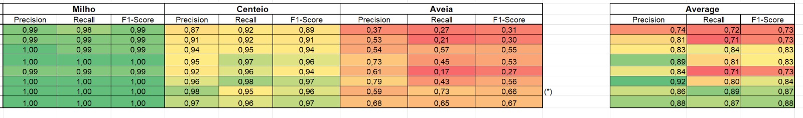
Using Machine Learning and statistical analysis to accurately identify crop species and calculate their specific land areas.
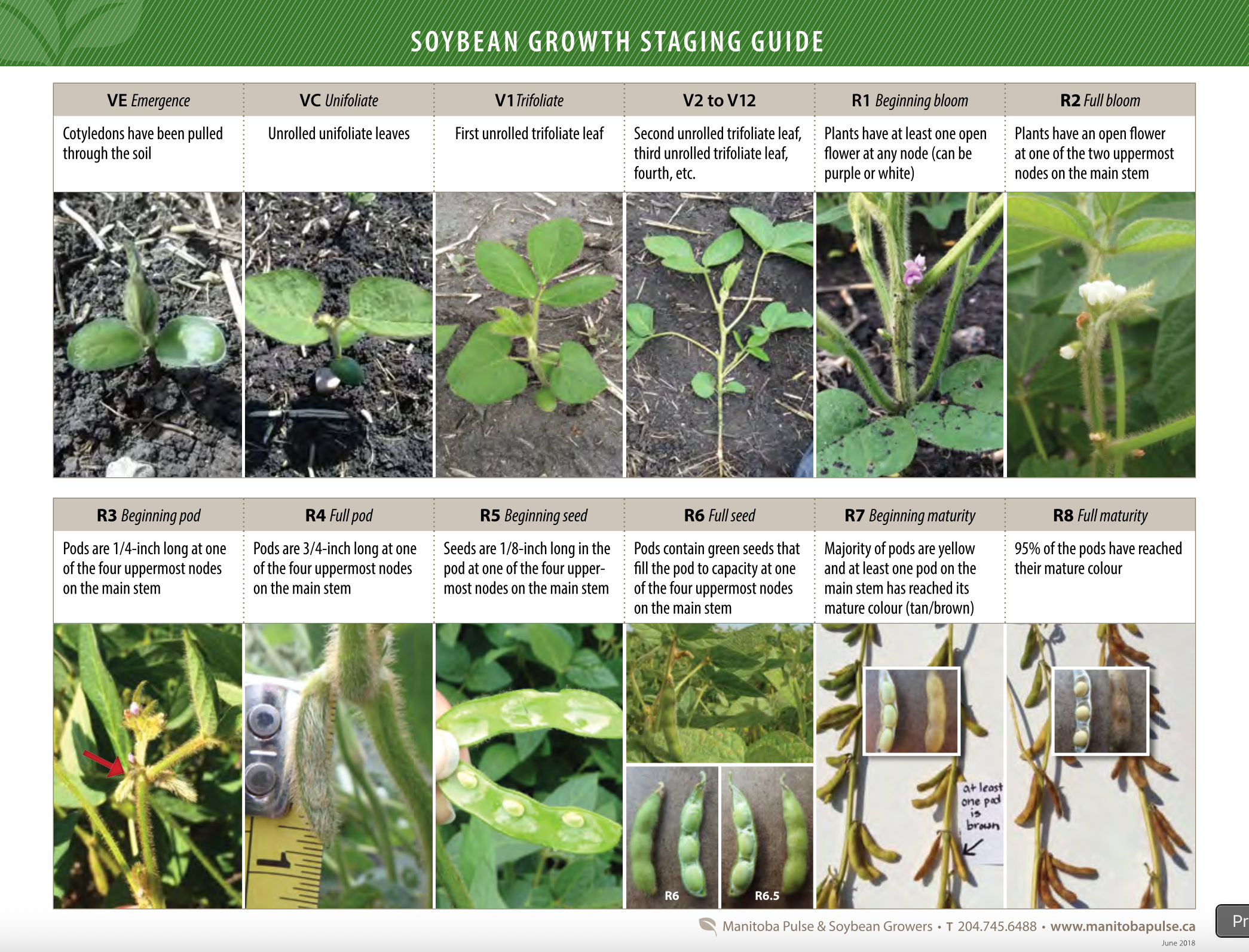
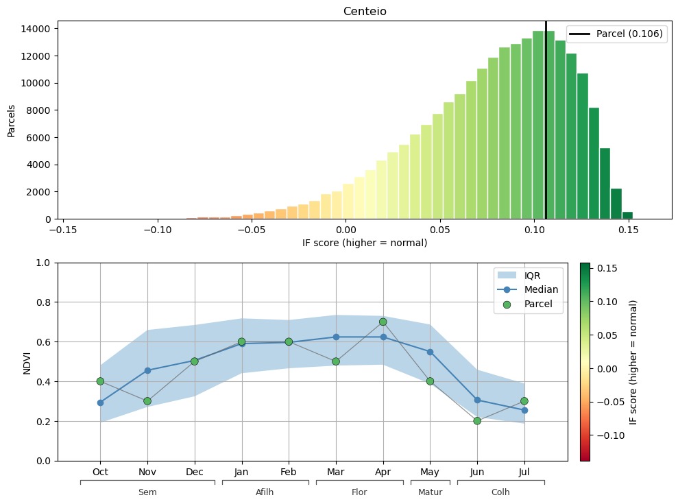
Leveraging Sentinel-2 satellite imagery to automatically determine and track the growth stages of plantations.
Replacing slow manual surveys with a fast and user-friendly digital process for insurance companies and financial institutions.

Ensuring data transparency to facilitate fraud prevention and simplify compliance with agricultural government aid programs.
Developed with support and feedback from academic, agricultural and technology stakeholders.

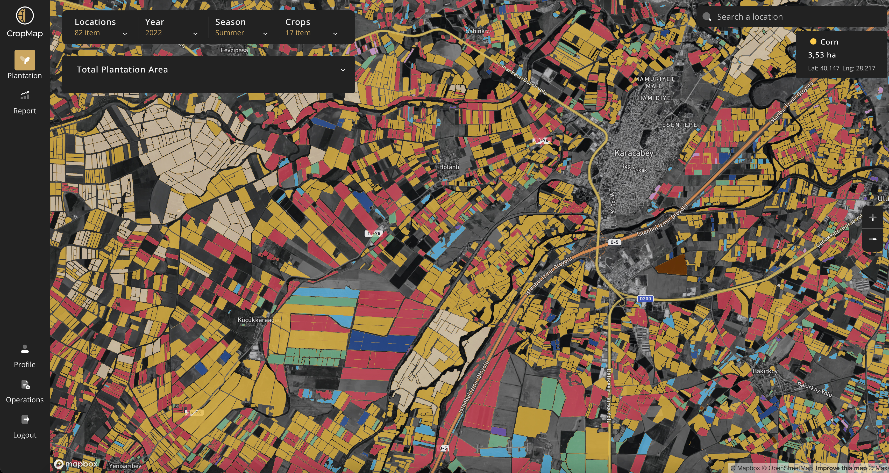
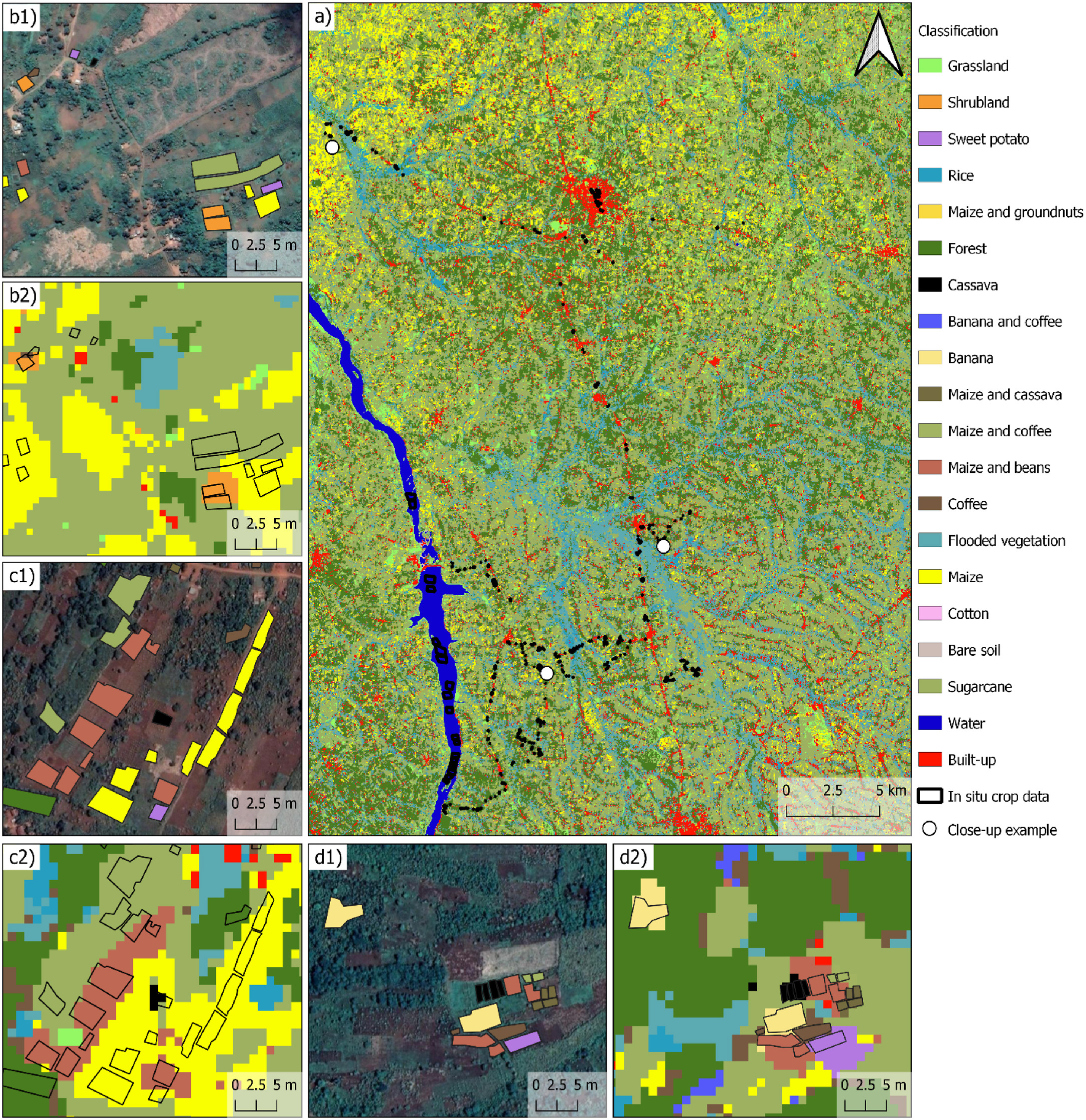
CropAuditing transforms satellite observations into practical crop-auditing information, turning remote sensing data into parcel-level outputs that support faster agricultural verification.
Space layer
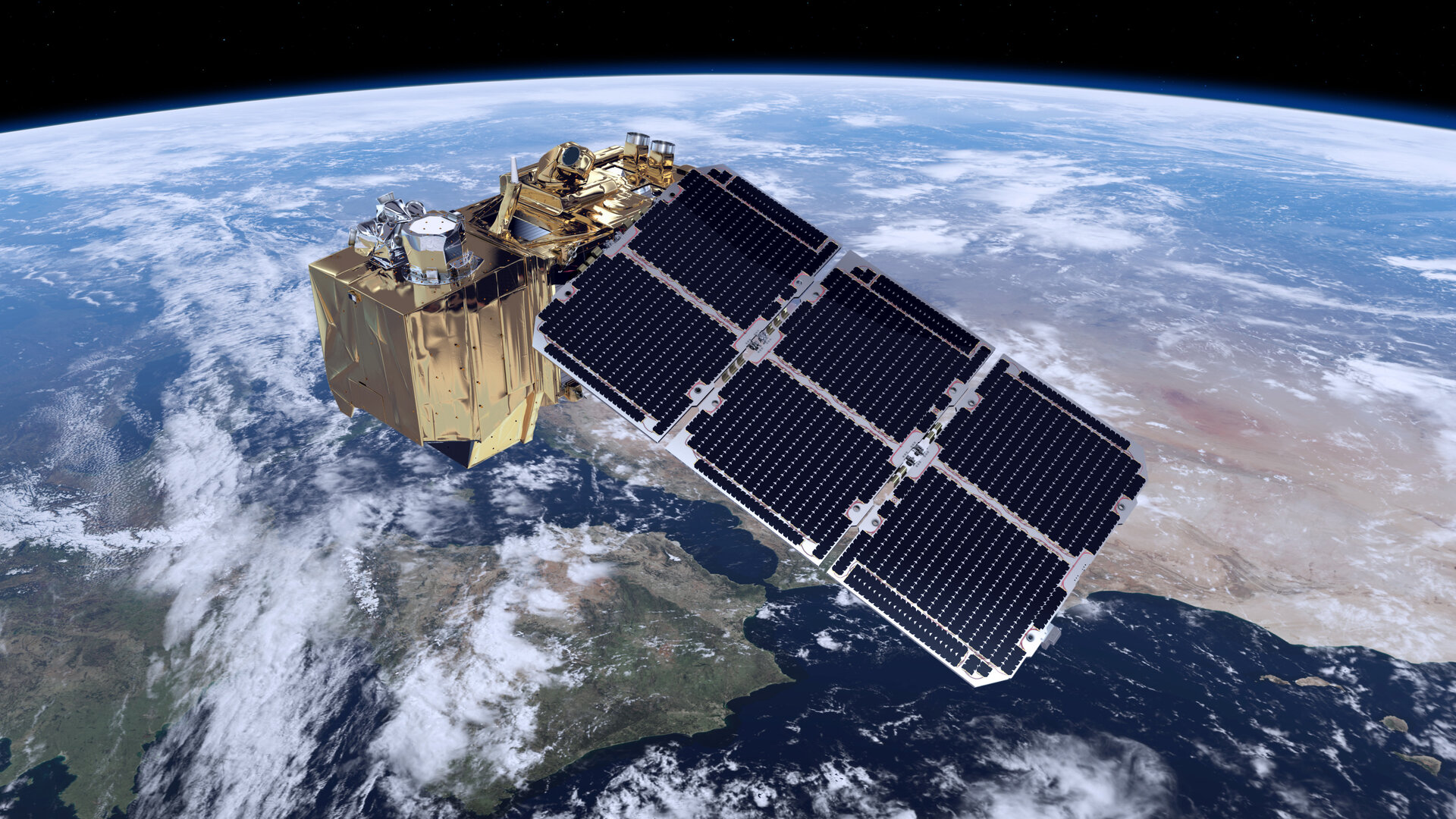
Sentinel-2 imagery and agricultural parcel information form the starting point of the system.
Vegetation signal
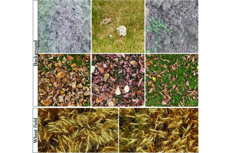
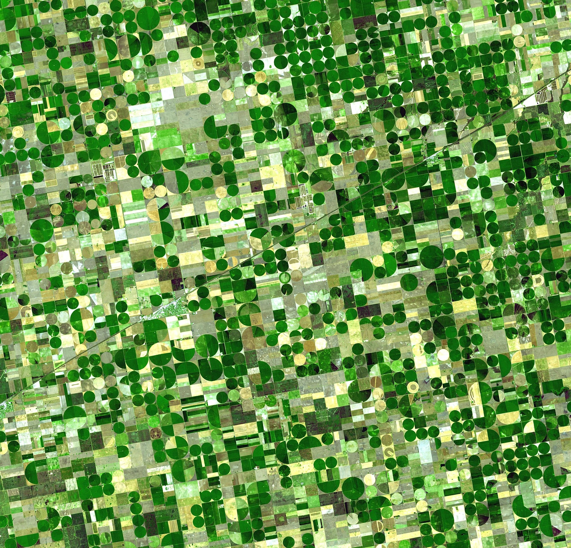
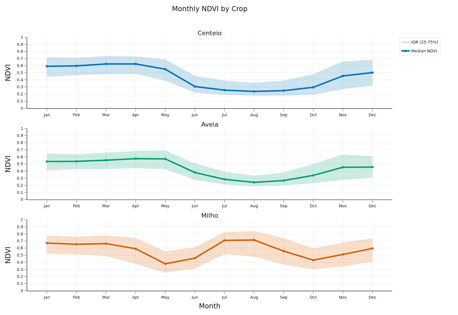
NDVI time series describe how crops evolve across the year and reveal seasonal patterns.
Analysis layer
Machine Learning models analyse satellite-derived patterns to identify crop species and support growth-stage interpretation.
Ground decision
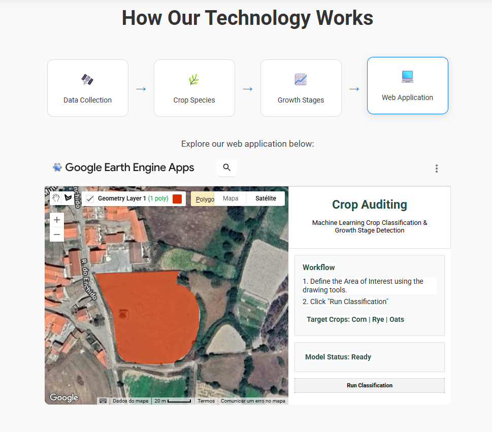
The web app presents parcel-level outputs that help users verify agricultural areas and support audit decisions.
Open Web AppA simplified overview of the CropAuditing development process, from stakeholder validation and data preparation to model development, prototype integration and final presentation.
The people behind CropAuditing, working across data collection, machine learning, web development and project communication.


Access our project documentation, reports, and deliverables.
Stay up to date with the latest news, projects, and articles from our group.
Week 1
Week 2
Week 3
Week 4
Week 5
Week 6
Week 7

Week 8
Week 9
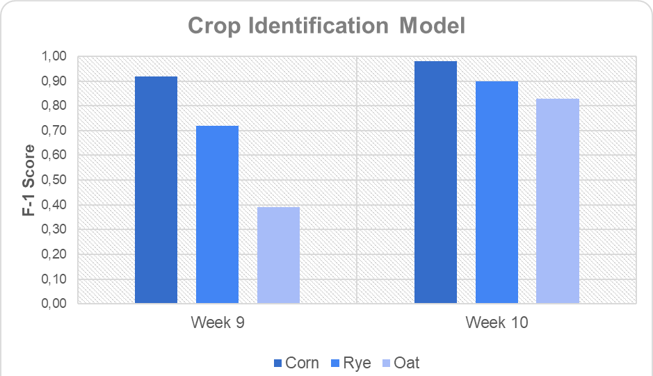
Week 10
Week 11
Week 12
We are available to answer any questions you may have about us. Leave us your message and email address.